Geographic Information Systems (GIS) for Mineral Exploration
Map Your Path to Discovery with Our Expert GIS Solutions
At Exploration Facilitation Unlimited, we harness the power of Geographic Information Systems (GIS) to drive intelligent and data-driven decisions in mineral exploration. Our team of GIS specialists works alongside geologists and geophysicists to analyze spatial data, identify trends, and interpret geological features that are critical to successful mineral exploration.
From detailed target and field mapping to government reporting-compliant mapping products, our GIS services streamline exploration workflows and support a range of applications. We leverage GIS to improve the understanding of spatial relationships, optimize field operations, and help clients make informed decisions backed by reliable, geospatially accurate data.
- Services include:
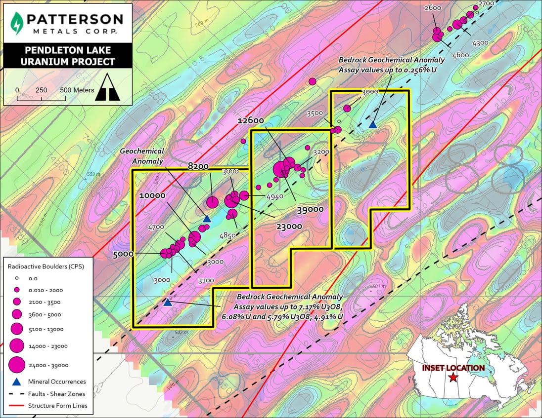
- Project Mapping for permit application, 43-101, Assessment Reports, press release, website, and promotional materials
- Drillhole map, plan and section plotting
- Digitization of historical maps and geographic data
- Satellite/aerial image acquisition
- and more...
Our GIS capabilities ensure that every step of the exploration process is supported by accurate, up-to-date geospatial intelligence, enabling better risk management, cost efficiency, and project success.
Where Geospatial Intelligence Meets Exploration Success.